The range card
Building a range card is very important. It allows you to quickly engage targets has they show up in your observation zone and is very useful for intelligence gathering.
Simply put, a range card is a sketch of an area. You identify targets, potential target locations, range references and add these to the card. Then you collect information.
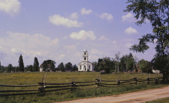
An example is always the best description. This is the area I am observing:
And here is the range card I drew:
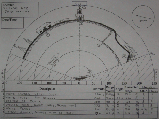
For each point, I include the following information:
- Id number.
- Azimuth.
- Description.
- Range in yards (e for estimate, l for laser, m for map).
- Range corrected for angle with the angle, if applicable.
- Elevation correction to apply to the scope, in MOA and clicks.
This is all done using a pencil since it might change over time (especially wind).
For specific buildings or complex locations, another drawing might be produced to show more detail. Or, if you have the proper equipment you could take a digital picture.
On a separate document, I write down all observations. Like time of arrival / departure of vehicles and individuals, complete descriptions, measurements of windows and doors, (use your mildot to evaluate the sizes),...